RM 9.35 Take out at Yucca Creek confluence
Continue downstream Yucca Creek to Paradise Beach (Class 4/5)
by Bill Pooley
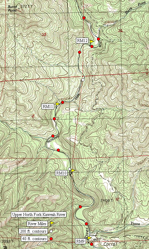
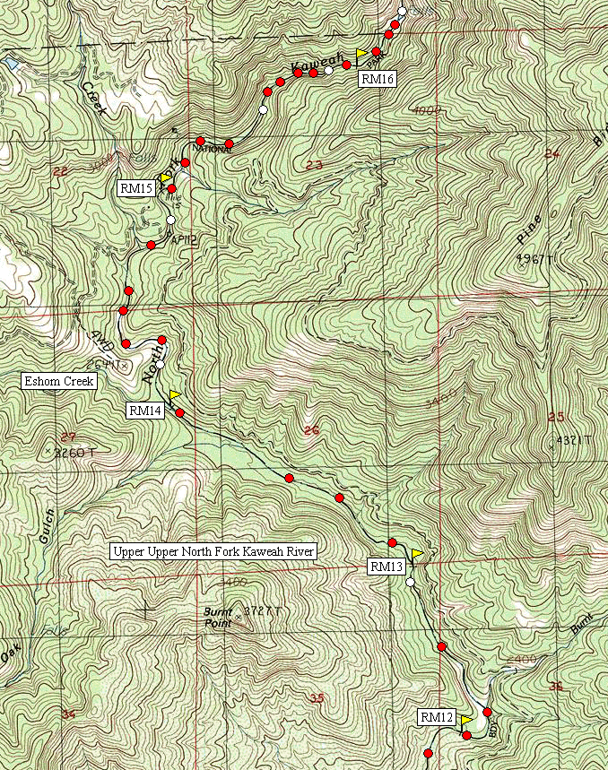
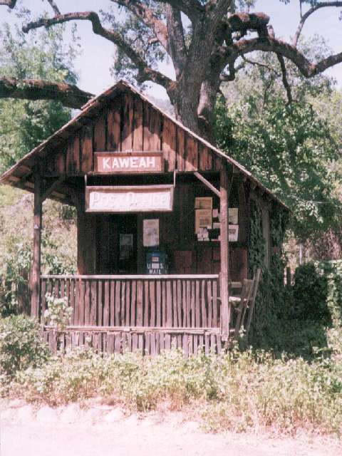
To get to the put-in cross the North Fork Bridge in the town of Three Rivers and drive 3.5 miles up North Fork Drive until the road crosses the river a quarter mile past the historic Kaweah Post Office. There is a new gauge on the left downstream side of the bridge footing (installed May 1997). A reading of 1.1 feet is a low water run at aprroximately 300 cfs. Continue upstream 8 miles upstream to where the road forks and the left fork goes through a gate and down to the river at the confluence with Yucca Creek. This spot is the take out. The old CCC road to Hidden Springs takes off here following the North Fork Kaweah upstream on river left. Ford Yucca Creek and start hiking. The put in is as far up as you feel like hiking. The run has alot of bedrock and sliding drops. It is reported this run becomes runnable as the normal North Fork run below Yucca Creek is becoming too low to run. The author has not yet personally run this section and when he does it will likely be done by hiking the boat in the day before and hiking back the day of the run with minimal gear.
Mile by mile gradient: starting at the Put-In
Continue downstream Yucca Creek to Paradise Beach (Class 4/5)
Copyright © 1997, 1998, 1999, 2000, 2005 by Bill Pooley. All rights reserved.
This page is http://www.c2.com/kaweah/log_uppernorthfork.html
Last modified: 06.02.00, 04.12.05